A few weeks after having climbed my first Mt. Fuji and Mt. Atago, I was very surprised that my hiking club was planning another hike in the same area.
This time we climbed the mountain Noko(納古山)which is 632.9 m high. Although we went by car, Mt. Noko can be accessed by train from the station Kamiasou(上麻生) on the Takayama line(高山本線). For more details and pictures please check this and this and this blogs.
Here is the guide map to the hiking course at the entry. There is a sign on the right of the map saying something like "caution, bears may appear" (熊出没注意 kuma-shutsubotsu-chuui). I found it funny that some of the signs showing the path to 納古山 where marked with such a scary red color line.
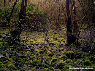
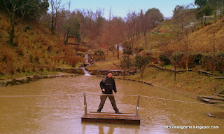
From the beginning, the scenery with its small currents slipping through big and rounded stones reminded me of my hike to Mt. Myojin a few weeks before. Perhaps it is thanks to all these currents—and the humidity that they generate—that the path is full of vegetation. In particular, I found the moss (koke in Japanese) on the trunk of the trees really beautiful.
But actually none of these pictures do justice to the atmosphere I was breathing there. For that reason, I decided to record a minute of sound of that place. I never thought that the sound of a few frogs could be so amazing!.
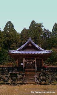
Apart from the moss and the frogs chant, we also enjoyed contemplating several species of trees and bushes in full blossom.
On the top, there is a map for helping you identifying the mountains that can be spotted from Mt. Noko. In clear weather conditions, you may be lucky enough to see Mt. Fuji (the famous one).
Mt. Noko is a really nice 1-day hike for people living near Nagoya.
Sunday, April 22, 2012
Tuesday, April 10, 2012
Mt. Myojin - 明神山 (愛知県)
The first time I climbed Mt. Myojin(明神山 - myoujinsan), I had a hard time crossing a dangerous rocky bridge near the top. I swore that I would never climb it again, but somehow I did it again last week.
Mt. Myojin is a 1016m high mountain located in Aichi prefecture, between Nagoya and Shizuoka. Although this time I went by car with some friends from my hiking club, you can get there by public transportation according to this and this blog. For more information and pictures, please check also this and this and this blog.
Before climbing, we bought a few sweet potatoes (焼き芋 - yakiimo) in a nearby konbini (Circle-K) and had them for breakfast.
The hike has a very good start: a beautiful river of crystalline waters winding among huge rocks. In fact, many rock climbers come to Mt. Myojin for training.
The forest is full of live. On the way up, we bumped into a cute lizard (トカゲ tokage in Japanese), who was literally posing for my camera. Also, I could see camellia flowers again as in Mt. Atago.
There is a viewpoint on the top from where we enjoyed the views of the Japanese southern alps. On a clear day, Mt. Fuji is supposed to be visible too but we didn't have the luck.
After a long and tiring hike, we went to an Onsen and then we went to see the cherry blossom in the city of Shinshiro.
Mt. Ibuki - 伊吹山
For some reason, Mt. Ibuki had been avoiding me for a long time. My hiking club in Nagoya had organized several hikes to Mt. Ibuki, some of them at night, but something would always happen to make my attendance impossible. So I'm especially glad that I finally made it to Ibuki!.
Mt. Ibuki is a 1,377m high mountain located near Maibara, at the east side of Biwa lake. Although this time we went by car, it is possible to get there by public transportation. You just need to take a JR train to Ominagaoka (近江長岡) and change to a bus bound for Ibuki-yama-tozan-guchi. (伊吹山登山口). Here is the bus timetable. From Nagoya, it should be around 1460 yen each way.
Despite it is a rather high mountain, Mt. Ibuki is normally rather easy to hike. In fact, there is a road on the other side of the mountain that let's you drive your car almost to the top. This time we climbed it in early April, so there was still a lot of snow and we needed crampons though.
There were quite nice views of the Biwa lake during the climb. However, once we reached the summit we wouldn't be able to see any landscape due to the fog.
Around the 5th station (Japanese mountains are divided in 10 stations or steps) the weather became colder and there was quite a lot of snow.
The climb became quite complicated because some parts where very slippery and my crampons where not really appropriate. In fact, some people had to give up and return. Fortunately, the rest of us managed to get to the top without any accident. On the top, there was a small shrine where we had lunch and got strength for the return.
The way back was much easier and we enjoyed good views of the sunset over the Biwa lake. It was a tough hike because of the snow but also lots of fun.
Monday, April 9, 2012
My first Mt. Fuji: 山之上富士 (yama-no-ue-fuji)
The Japanese love Mt. Fuji to the extent that they have named many other mountains after it. There is a list of 321 mountains (mostly in Japan but surprisingly also in other countries such as Taiwan) whose name is composed of the word Fuji, prefixed with some local name to distinguish it from the rest. This list is known as 郷土富士 (kyoudo-fuji) or ふるさとの富士山 (furusato-no-fuji).
View Larger Map
The first Mt. Fuji I climbed is called 山之上富士 (yama-no-ue-fuji), and it is located in Gifu prefecture. Public transportation is not very good, but you can go to Nakakawabe station by train and then walk (or ride your foldable bicycle) until the entrance to the hiking course.
It is a very easy hike (the mountain is 357.2m tall) but nice for a relaxing day. For detailed information and pictures about this mountain, please refer to these sites: this, this and this.
The starting point is a bridge called 富士見橋 (fujimi-hashi) which has colorful monkey figures embedded.
The path to the top is easy to follow. On the top there is a small shrine with some interesting statues.
Although the day I went there was raining, and I was using my phone's low-quality camera, you can appreciate that the views are not bad at all for such a small mountain.
After the hike, you can enjoy a beautiful park near the bridge where you started. In this region, there are a lot of fireflies (ほたる hotaru in Japanese).
You can also give food to the fishes in a small pond. As you see, you have to put the money on a small bin and maybe once a week somebody will pass by to collect the money.
After a rainy day, nothing like a good spa. I went to yu-no-hana spa which is one of the best I have ever been to in Japan. For 1700 yen, you can stay the whole day there. They have many things to enjoy and relax (a manga library, comfortable seats and beds, TV, computers, saunas, jacuzzy, restaurant, etc.) while you contemplate a beautiful landscape with mountains and rivers.
Sunday, March 25, 2012
Mt. Atago (愛宕山)
This weekend I went for a short and relaxing hike in Gifu prefecture (岐阜県). The mountain I climbed was Mt. Atago (愛宕山). Check this and this blog for more detailed information (in Japanese).
Although Mt. Atago is just a small hill (261 m), there was a good reason for going there. You might find it strange but sometimes I decide where to go based on some unrelated characteristic, such as the name of a place (check my post about my visit to Sango town :D). In this occasion, the area where the mountain is located has a name that many of you may have heard: 福島 (Fukushima). Additionally, the mountain is also referred as 米田富士 (yoneda-fuji) which reminds me of 富士山 (Mt. Fuji) the famous Japanese volcano. In fact, there is a mountain called 富士山 nearby but I'll talk about that in another post.
Mt. Atago stands in front of the little town of 中川辺 (Nakakawabe), right at the other side of 飛騨川 (Hida river). It is very easy to go there by train from Nagoya (e.g. Nagoya-Tajimi-Minoota-Nakakawabe). There is a festival with fireworks every year in Nakakawabe and people gather by the river to see them.
The path to the top is well indicated and it is a pleasure to walk, especially after a light rain. During this time of the year (late March) you can see many camellia flowers (ツバキ tsubaki in Japanese).
There is a beautiful Shrine called 加茂神社 (Kamo Shrine) on the way. In front of it, there is a small wood building with an Engawa that is just perfect to take a brief rest.
I'd suggest this short hike (around 1 hour walking) for people living around Nagoya who want to escape from the daily stress. The country side (田舎 inaka in Japanese) is really beautiful and worth a walk. After the hike, you can go to have a relaxing bath in 湯の華 (yu-no-hana) spa, close to 可児川駅 (Kanigawa Station).
Subscribe to:
Comments (Atom)


