Tuesday, December 25, 2007

Mum, I want to be an artist!

This is not about a new trip or something like that. It's about the year 2007 coming to an end, and me wanting to start doing new things. So I tidyed up my room and converted it into my new art studio!!


I have new ambitious plans to be a comic artist and also to be able to create my own songs. First I need a lot of practice of course. I put here some links of the first songs I have made with the help of my harmonica, my voice and some software:

deb_is_coming_to_spain.mp3
a_message_from_the_sky.mp3
on_the_train_to_chicago_city.mp3

I will get better, promise!

Monday, December 24, 2007

Sierra del Hornijo

Last sunday I did a new route in a valley close to the last route (Monte Ranero), the valley of Soba. In the following picture we can see how Monte Ranero looked like from the new route (for beginners: you can click on the pictures to see them in a bigger size):


Soba is a very beautiful and important valley and it gives name to a delicious dessert called "Sobao", very typical from Cantabria. You can also find here the source of the river Ason, with a spectacular waterfall in a precipice. This time I took my bike with me because I wanted to finish the route soon enough to take the train back at 14:20 (otherwise I would need to wait for the one at 20:50). My route didn't pass by the waterfall though.


I wanted to cross the mountain range "hornijo" trough an aperture that people from Ramales know as "La Canal de Ancilla" and people from Soba call "Ventana de las Trapías" (I checked it, by the way). Here is a link to the route in Google Earth.


I took a FEVE train in Santander at 8:00 and arrived at the village of Gibaja at 9:22. From Gibaja I ride my bike through a general road to the nearby town of Ramales where one can contemplate the astonishing figure of the peak San Vicente (not the highest one in Hornijo though) and "La Canal de Ancilla" (see the picture above). Note that normally the ascension to San Vicente is not done from its north face but from the south (we will see it in another picture).

The ascension from there was very hard and I had to go on foot most of the time. On the entrance to "La Canal" a bunch of dogs came barking at me in a very aggresive way. I think this should be illegal, prosecuted and punished. This people with aggresive dogs must think they are the only ones allowed to walk in the area.


Crossing "La Canal" was really hard because I had to walk and hold my bike at the same time. I was exhausted!!(I retouched my face in the picture to make it clear, haha) There was not a clear path, lots of stones and bushes so it was not appropiate for a bike at all. I do not recommend anyone to do the same, it requires a bit of experience and being crazy!!


I managed to see some deers (I guess) and took some pictures of them.


When I finally crossed "La Canal" I could see the amazing views of the valley of Soba. I took some photos to convert them into a panoramic one. I had planned to go a little bit to the west but I didn't have enough time for that (going through "La Canal" was harder than expected) so I decided to go downhill.


Now, the pain of taking the bike on my shoulders there was finally worth the effort. It was a real pleasure to go down the valley. Above we can see the south face of the peak San Vicente which is normally accessed through the village of Manzaneda.

Finally I arrived at the station of Gibaja 20 minutes ahead. I had the chance to talk to the station chief who is from Santander. He told me that the station is driven in the old way ("bloqueo telefónico") which means that the signaling is not automatic but through asking-giving permission by voice calls (the signals are then controlled by him through a laptop).

Sunday, December 16, 2007

Monte Ranero

This post will have an unsual amount of pictures so I'll try to make the speech shorter :). Last Saturday, I went with my friend Felipe to do a nice route to the beautiful hill of Raneros, located in the border between Cantabria and the Basche Country. Here is a link to a Google Earth path file containing the route to Monte Raneros so you can see where it is by yourself. This time, I didn't need to take my GPS out because the route was easy enough.


We took a FEVE train early in the morning, departing from Santander at 8:00 and arriving at Carranza station (Ambasaguas, Basche Country) at 9:37. It was a cold morning but still good for this time of the year (December 15th).


After having a cup of chocolated milk and buying a "bocadillo" (like a sandwich but with French bread) in a bar, we started following the general road BI-630 straight to the cave of Pozalagua.


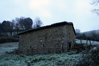
In the picture there is a nice example of the typical huts in this region. For me, it usually goes unnoticed. But I thought it might be good to show one of them to people from all over the world because they are quite nice!
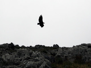

We didn't visit the cave though, because it was kind of a touristical attraction and we felt that we were not there for that. In a few minutes from the cave, using a slightly visible path, we reached the top of the hill (we scared some vultures as well).


The views from there were amazing and we took some nice pictures in the border of a precipice.


The ground there was a bit tricky because the grass was dense and hid the holes bellow.
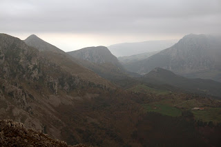
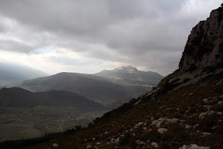
Then, we went down again and enjoyed a very nice walk on the crest and through a beautiful forest. I took some pictures there to compose a panoramic photo with software. Here are the results, they look nice to me.


Felipe had a very good camera and we took some pictures of ourselves hehe.


There were some hunters there and for a moment, I felt a bit unsafe. Next time I will take an easy to view jacket with me just in case.
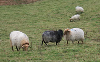

We also saw a black sheep fighting with another one.

By the time we arrived at Gibaja (Cantabria) it was only 16:30 and the next (and last) train to Santander was at 20:50 (there are only 3 trains each day to Santander from Gibaja). We entered to a bar called Whisky and we stayed there until it was time to go. We had the opportunity to chat with some nice people there about a lot of things. The owner of the bar, Nisio, who used to drive a Taxi in his youth, was the one who gave us the first welcome. He showed us some other nice routes around, like that one to see the source of the Ason river. He also said we had missed the most interesting parts of the route, the cave and a zoo called "el carpin" (I disagreed
with him, but didn't tell anything) and that we should have done the route the other way around (maybe he was right about that but I planned to do it this way so we could start a bit later, therefore not so cold, and see the range of mountains from the train).

We also chatted with a couple coming from Bilbao (the guy was called Mikel, I don't remember the woman's name) about politics, how to save the world, racism, the differences among people in Spain depending on their region, etc. Although we were still in Cantabria, most of the people there were Basche (even the bar was furnished with Bilbao's football club posters). We also talked to another nice guy, called José "Miel" (Miel means honey in Spanish, he works growing bees) and a woman with so many descendants that she won't have room for them in Christmas dinner.

Before taking the train back to Santander we had a great Spanish omelet with tune and a sandwich in another bar near the station. José Miel, who said there were only four bars in Gibaja (being Whisky the most popular for the youth thanks to the music that his nice barman plays -- he is used to go outside, especially to Ibiza, to get to know the last trends in house music, etc :D), recommended us that bar because it had some beautiful girls there haha, "two from Bilbao and a beautiful southamerican", he said. When we get there we only found the latin girl, Colombian, and yes, she was gorgeous! haha. See you soon!

Saturday, December 1, 2007

Getxo Comic and Manga Festival 2007

Last weekend I attended to the annual Comic and Manga Festival in Getxo, a small district of Bilbao (north of Spain) . Although the activities in the festival were not very interesting, basically everything could be reduced to shops selling comics and figures, I enjoyed myself very much thanks to the company of some new friends that I made. They were interested in comics and illustration like me and I got to know them thanks to Yvon, a friend from Getxo that I met in Barcelona for the first time one summer some years ago when we had the opportunity to work for an animation studio called dibutoonz studio. It also came Talia, the girl I went to the Ganekogorta with some weeks ago, who said she was having the most freak day of her life, haha.

One of the few interesting activities was the conference by Miguelanxo Prado (its name is mispelled haha). He just made an animation movie after leaving his job for Man In Black and talked about a new revolution for it.

The festival was splitted up in two parts: comic and manga (Japanese comics). Definitely, the manga part was more funny haha. There were people dressed up like their favourite characters, karaoke, bump-it-up contests, Japanese food, merchandising...

At lunch time we went to a nearby commercial center to eat. After having lunch we took out our pencils and started drawing a little bit.

It was a nice day and I recovered a little bit my illusion for this fantastic world of drawings, stories, characters, etc.. called comic. At night, Talia and I went to see a performance by my harmonica teacher Pablo Almaraz in a nearby village. It was the best end for a freaky day!

Sunday, November 18, 2007

Cantabria by bike - route 9 - Alsa

Last sunday I decided to do the route number 9 from Cantabria by bike (http://www.cantabriaenbici.com/) which starts and ends at Bárcena de Pié de Concha. I did it with a sligth variation so I put here a kmz file to see it in google earth: bárcena-alsa-peakJano kmz google earth.

I took the train that leaves Santander at 8:18 and in an hour or so I was in Bárcena. This time I made sure I was not going to commit the same mistakes as in my previous BTT route.

For example:

  1. I put a lot of points in my GPS so I didn't get lost easily
  2. I put my GPS on the handlebars with a bit of McGiver's style (hehe)
  3. I took a bottle of 1,5 litres of water (next time I'll took 2 litres)
  4. My bike's wheels were in good condition (I bought a Michelin tube)

The route was very hard compared to the last one. I did 43 Kilometers starting at9:30 and finishing at 17:30 (be careful with the duration of the routes on the website, those are for trained people!!). I made a slitght variation of the route at the end were I decided to, first, climb the peak Jano and then I used another path to go back to Bárcena that I learned in a previous route.

The first part of the route was very tough for my legs, always uphill, ugh!! There was a funny story though (well, NOW is funny). I was riding my bike and suddenly I heard a dog barking at me and running towards me. Maybe it was just a German shepherd but at the moment it was like a mixture of a Doberman and Godzilla!! I started to run faster and faster while I saw how the damn dog managed to get through a fence. It wasn't going to stop until it bit me!! So there I was, escaping from the dog when suddenly, like in the movies, I saw a stream in the middle of the path. Oh my god! On one hand, I wanted to stop cause the stream was depth and I thought I would fall down, but on the other hand I had the dog's jaw 3 seconds behind me!! Finally, I went through the damn "river" like a WARRIOR!! knife in mouth!! the dog stayed there (coward!! XD). Of course, I have no pictures to illustrate the story :D

I'd like to invent a gadget that could do the following :)


The rest of the path in the forest was quiet and nice.

When I got to the hill of Paguenzo I decided to rest and eat something. Then, after some more slopes I started to go down (at last!). The way down was a real pleasure but very short, because in no time I was going up again to the village of Santa María de Aguallo. It was hard going up that road after so many kilometers but once you get there you have a beautiful way down until you get to the Alsa reservoir (hey, the one in the picture is not tintin, it's me!!).

From the Alsa reservoir there was still a long long long eternal road to the dam of mediajo frío that I had to do on foot because all my energies were gone. I had to rest and eat very often.. I didn't have too much water left in the bottle.. It was going to get dark... but... I went up and up like a WARRIOR until I reached the peak!! AAAAAAAAAAAAAAAAAAAAAAAARGHHH!!!!

I was thinking that the rest of the route was going to be a piece of cake when I started going down the mountain to discover that I was going toooooooooo fast!!! Oh my god, I had to press my brakes HARD all the way down and my hands were really painful. The path wasn't easy at all, lots of stones that I had to avoid at a great speed and I was screaming and shouting "I'm gonna dieee!!" haha!

Eventually I got to Bárcena alive and just in time to take the train back to Santander at 17:50. Uf!

Wednesday, November 14, 2007

Ganekogorta - second time

In a previous post I described a route from Bilbao to Llodio passing through the mountain Ganekogorta. As I said on that occasion, the "Ganeko" is a very popular hill near Bilbao, where its residents go for a walk very often, especially on weekends.


This weekend I decided to go there with a new friend, called Talia, who also likes hiking and lives in a nearby town, Getxo. We did the classical route that starts at San Adrián and goes to the Ganeko through another hill, called Pagasarri (although I tend to spell it as Pasagarri haha). I put here a link of the kmz file of the route to see it on google earth: google earth gps route

We had the luck of having a great weather with a beautiful blue sky above, that really made our day. The walk was very nice and relaxing, watching sheeps eating grass, cows, hikers here and there.

It is always surprising to find a place so close to an industrial city, where you can have such good views of mountains and nature as here. In the picture above, we can see the beautiful shape of the Ganekogorta.


On the top of the Ganeko, there was this beautiful "oasis" (see the picture above) where we decided to lie down, eat some chocolat, get tanned (ha!) and relax.

Hemen, hemen zu ta ni bakarrik... bakarrik munduan...
(here, here you and me alone... alone in the world...)
from a song in Basche language by Urko

After having lunch we went down to Bilbo! We saw some people starting the ascension and it was already getting dark!! Apa!! ('Apa', 'Aupa', 'Epa' are the keywords when you go to this route, hahaha! It means "cheer up!" and it is usually said among hikers)

Note: there are two retouched pictures in this post, can you find them? Then put a comment! :)